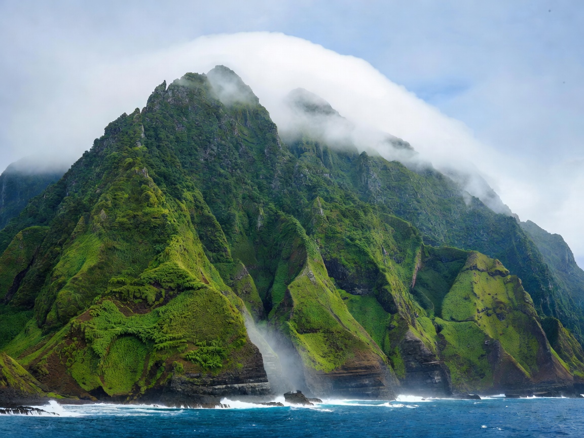
The north–south split
Madeira's central massif runs roughly east–west and forces the prevailing northeasterly to rise, condense and dump its moisture on the northern slopes. The practical consequence is a reliable pattern rather than a rule: the south coast around Funchal tends to be drier and sunnier, the north and northeast greener and wetter, and the high ground above the cloud layer can be brilliantly clear while both coasts sit under grey.
This is why a fixed day-by-day itinerary underperforms here. Build a list of candidate outings tagged by altitude and aspect — high ridge, north coast, south coast, town — and choose each morning based on the forecast and what you can see from your window.
Levadas: what you are actually walking
The levadas are irrigation channels, some centuries old, cut into the mountainside to carry water from the wet north to the cultivated south. Maintenance paths beside them make up the island's walking network, and they are the main reason people return. Grades vary enormously:
Easy channel walks
Near-level paths beside the water, wide enough to pass comfortably, often through laurel forest. Suitable for most fitness levels; the hazard is usually the drop on the open side rather than the climb.
Tunnel and exposure routes
Sections through unlit rock tunnels or across narrow ledges with long falls. Head torch, waterproof and steady footing required; not for anyone uneasy with heights.
Mountain traverses
High-altitude ridge routes such as the link between Pico do Arieiro and Pico Ruivo: sustained ascent and descent, stairs, tunnels, and a real weather commitment. Some routes carry an access fee and require registration.
Routes are officially numbered and signed, and closures after storms or landslides are common. Always check current status with the regional forestry and nature authority before committing to a long route, and note that some trails now require a paid permit booked in advance.
Getting around
Public buses connect Funchal with most coastal settlements and are inexpensive, but timetables are built for residents: good in the morning and late afternoon, sparse in between, and thin at weekends. They will get you to a village; they rarely get you to a trailhead and back on the same day.
Hiring a car gives you the island's real advantage — being high up at the right hour. The costs are a steep learning curve on 1-in-4 gradients, hairpins, narrow village lanes, and expensive or scarce parking in central Funchal. If you are not confident on mountain roads, combine taxis, organised transfers and guided walks instead; many walking routes are point-to-point and need a pick-up anyway.
Funchal and the rest
Funchal holds most of the accommodation, the market, the old town restaurants and the cable car up to Monte. It is a comfortable base for the first half of a trip. For the second half, moving northwest to the Porto Moniz or São Vicente area, or east to Machico and Caniçal, cuts a lot of driving and puts you closer to sunrise light on the ridges.
Porto Santo, the sister island, is a ferry crossing of a couple of hours from Funchal and is a completely different proposition: flat, dry, and built around one long sandy beach. It is worth two or three nights if beach time is a priority, and worth skipping entirely if you came to walk.
Pros and cons
Strengths
- Reliable year-round mild climate with no true off-season.
- World-class walking network at a range of difficulties.
- Short distances — dramatic scenery within an hour of the capital.
- Good value food and wine, especially away from the harbour front.
Frictions
- Few sandy beaches; swimming is mostly pools and rocky inlets.
- Driving is demanding and parking is tight in Funchal.
- Trail closures and cloud can wipe out planned highlights.
- Popular viewpoints are busy at sunrise, with limited parking.
An eight-day shape
- Days 1–2 — Funchal. Market, old town, Monte cable car and gardens; a short low-level levada to test your legs.
- Day 3 — East end. The Ponta de São Lourenço peninsula early, before the wind and the crowds.
- Day 4 — Move north or west. Relocate, stopping at high viewpoints if the ridge is clear.
- Day 5 — Laurel forest walk. A forest levada in the wetter interior, which is at its best in mist anyway.
- Day 6 — High ridge, weather permitting. Hold this day for the clearest forecast of the week.
- Days 7–8 — Coast or Porto Santo. Natural pools and sea swimming, or the ferry across for beach days.
Before you go
Pack layers and a proper waterproof regardless of season; the summit can be cold and wet while the coast is warm. Carry a torch for tunnels, check official trail status the evening before, and tell someone your route. Book the permit-controlled high routes as soon as you know your dates, and treat any sunrise plan as provisional.
Next: The Azores, where the weather variability of Madeira is multiplied across nine separate islands.