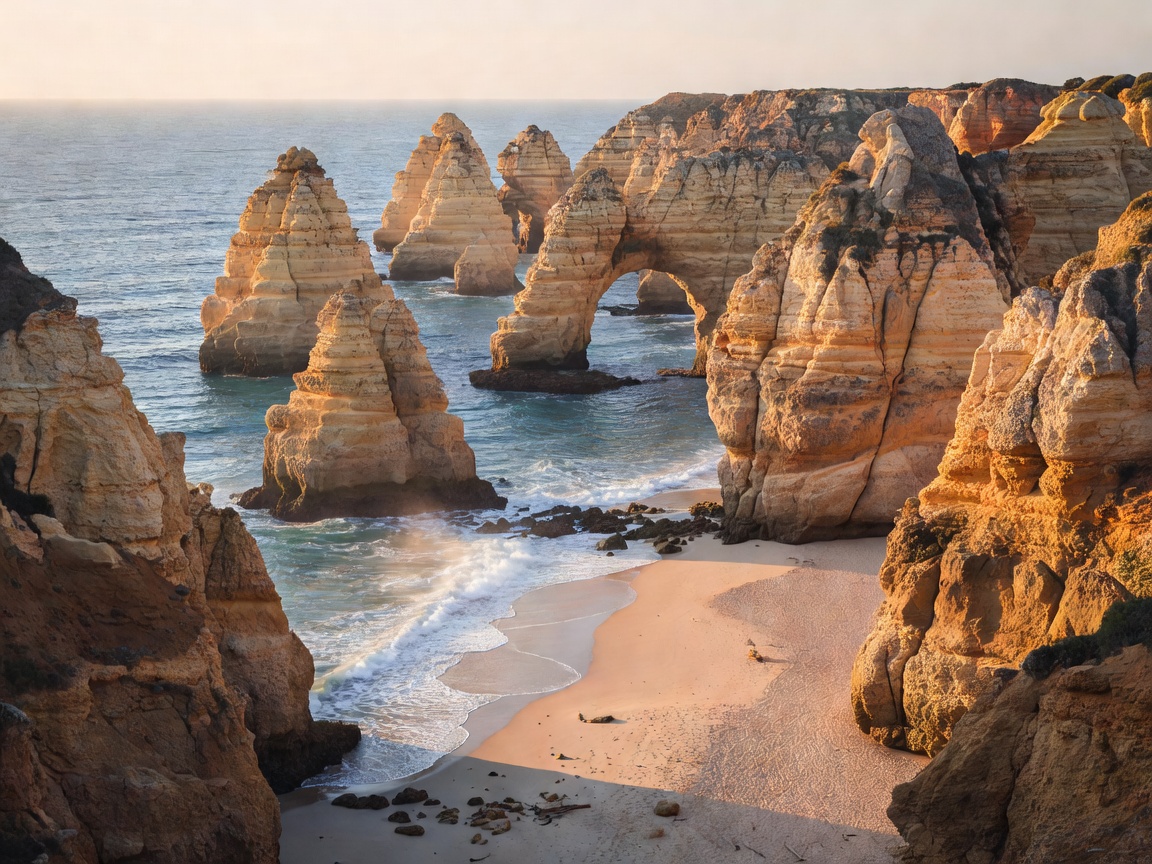
The three-coast model
The central limestone coast, roughly from Lagos through Carvoeiro to Albufeira, is what appears on postcards: ochre cliffs, sea caves, tiny coves reached by stairs. It is also where development is densest, so the same stretch holds both the best scenery and the heaviest crowds.
The eastern lagoon coast, from Faro through Olhão to Tavira and the Spanish border, is completely different. Here the sea is held behind a chain of barrier islands and salt marsh — the Ria Formosa. Beaches are reached by ferry, the landscape is flat and birdy, and the towns feel like working Portuguese towns rather than resorts.
The west coast, turning north from Sagres up the Costa Vicentina, faces the open Atlantic. Wind, cold water, big surf, few buildings and long walking trails. It is the antidote to the central strip and the reason to rent a car.
Where to base
Rather than moving every night, most trips work best split between two bases — one west or central, one east. Lagos is a practical western choice with a rail station, a walkable centre and access to both cliff coves and Sagres. Tavira or Olhão work well in the east for lagoon ferries and quieter evenings. Faro is convenient for arrival and departure and better as a base than its reputation suggests, especially in shoulder season.
Resort towns built around golf and all-inclusive hotels are fine if that is the holiday you want; they are less useful if you intend to be out at sunrise on a clifftop path.
Transport reality
A regional railway runs along the Algarve roughly parallel to the coast, connecting Lagos, Portimão, Albufeira's inland station, Faro, Tavira and Vila Real de Santo António. It is cheap and pleasant, and for a town-to-town trip it is the easiest option. What it does not do is deliver you to individual beaches or trailheads, many of which sit several kilometres from any station down a single lane.
That is why a car is recommended here while it is optional in the north. If you do drive, note that the main east–west motorway uses electronic tolling; foreign-registered vehicles need either a rental company transponder or one of the registration options offered at the border and on arrival. Parking at popular cliff beaches fills very early in summer and the approach roads can become gridlocked by mid-morning.
Boat trips are the third leg: small-boat tours along the cliffs and into the sea caves, and ferries out to the Ria Formosa islands. Cave tours are weather-dependent and sea conditions cancel them regularly, so book early in your stay rather than on the last day.
Season by season
- Spring. Wildflowers on the barrocal, comfortable walking temperatures, cool sea. The best window for the clifftop trails.
- Early summer. Warming water, long days, rising crowds. Book accommodation well ahead.
- Peak summer. Hot, busy and expensive; beaches near car parks are full by mid-morning. Go east or west of the main strip.
- Early autumn. Often the sweet spot — warmest sea of the year with thinning crowds.
- Winter. Mild, green and very quiet. Many beach businesses close; walking, birdwatching and towns take over.
Pros and cons
Strengths
- Enormous variety within short driving distances.
- Warmest sea temperatures on the Portuguese mainland.
- Excellent long-distance walking on both the cliff and west coasts.
- Good low-season value and a genuinely usable winter climate.
Frictions
- Peak-summer congestion around the central beaches.
- Cliff edges are unstable; marked setbacks exist for good reason.
- Public transport does not reach most trailheads or coves.
- Some resort areas feel detached from regional food and culture.
A six-day split
- Days 1–2 — West. Base near Lagos. Clifftop walking, a cove morning, and an evening at Sagres for the headland light.
- Day 3 — Costa Vicentina. Drive north along the wild coast; stop at two or three beaches and expect wind.
- Day 4 — Transfer east. Rail or road to Tavira or Olhão, with an inland stop in the hill villages if you are driving.
- Day 5 — Ria Formosa. Ferry to a barrier island, flat sand, shellfish lunch, birdlife on the return.
- Day 6 — Flex. Boat tour if the sea is calm; otherwise a market town and the salt pans.
Before you go
Check swimming conditions rather than assuming: the same day can offer glassy water in an east-facing cove and dangerous shore break on the west coast. Respect lifeguard flags, keep back from cliff edges and off undercut overhangs, and carry water on the trails — there is very little shade on the barrocal. For beach safety and protected-area rules, consult Portuguese authority guidance before you set out.
Next: Madeira & Porto Santo, where altitude replaces distance as the main planning variable.